- Services
- 3D Laser Scanning
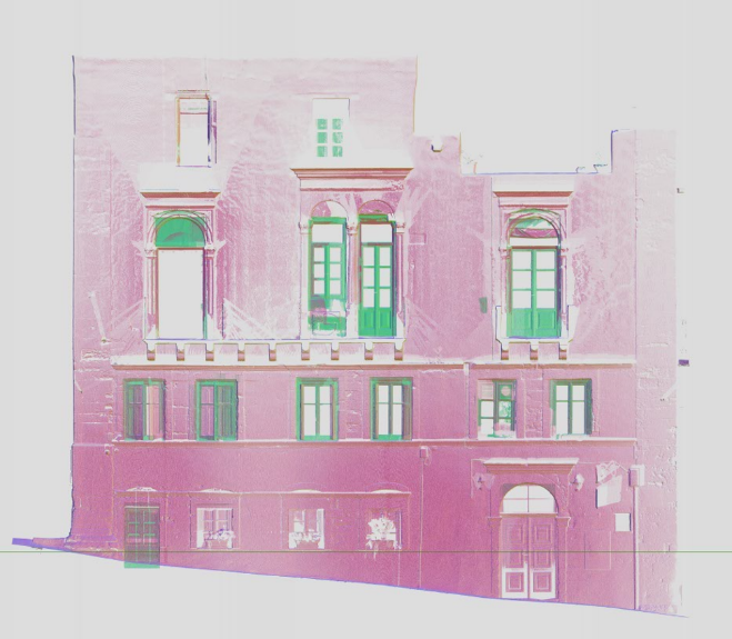
The method works by collecting a cloud of points remotely with high speed and accuracy. The data collected in a 3D scan can be used to produce floor plans, elevations and cross-sections. We can also produce realistic 3D visualizations.
- Renovation
- Reconstruction
- Restoration of buildings
- Restoration of Monuments, Churches, Special Buildings or Restoration of Listed Buildings
- Mapping of complex interiors of buildings or industrial facilities
- Establishment of Building Information Models – BIM
The office uses the latest 3D scanning technology, capturing over 1 million points per second, to produce extremely high levels of detail and accuracy.
The final deliverable can also be delivered in pointcloud format. This makes it possible for a third party user, via a free add-on, to view, edit, zoom, measure and mark up information. It is quick and easy to use and allows the extraction of coordinates and measured distances from point cloud data. The generated products can be in various formats, such as 2D/3D Autocad drawings, point cloud, reduced images.